


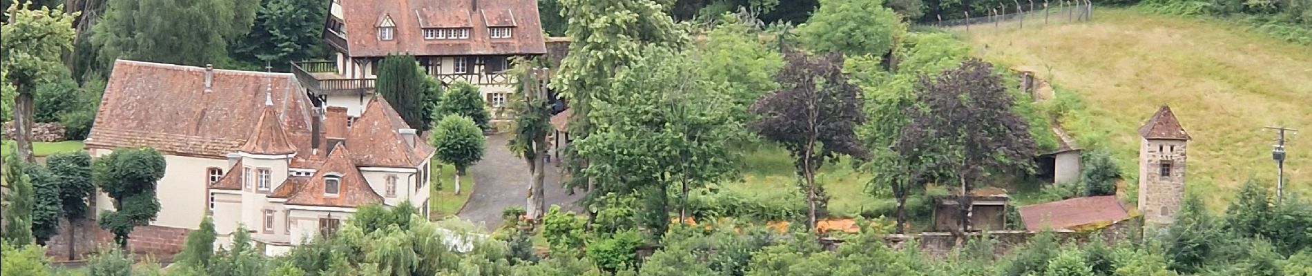
St Martin

MoiClaude
User
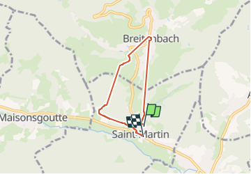

Length
4.6 km

Max alt
438 m

Uphill gradient
265 m
Km-Effort
8.1 km

Min alt
281 m

Downhill gradient
266 m
Boucle
Yes
Creation date :
2024-07-02 08:15:32.946
Updated on :
2024-07-02 10:57:29.625
2h09
Difficulty : Medium

FREE GPS app for hiking
 SityTrail
IGN / Geographical institutes
SityTrail Plus
The world is yours!
About
Trail Walking of 4.6 km to be discovered at Grand Est, Bas-Rhin, Saint-Martin. This trail is proposed by MoiClaude.
Photos

Positioning
Country:
France
Region :
Grand Est
Department/Province :
Bas-Rhin
Municipality :
Saint-Martin
Location:
Unknown
Start:(Dec)
Start:(UTM)
373413 ; 5356754 (32U) N.
Comments