


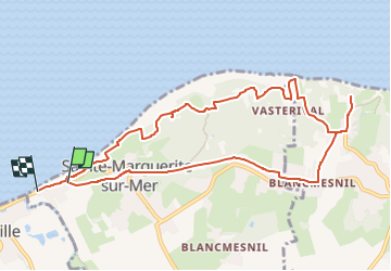
St MARGUERITE - Cimetière marin VARENGEVILLE

juanluco76
User

Length
9.9 km

Max alt
91 m

Uphill gradient
156 m
Km-Effort
12 km

Min alt
4 m

Downhill gradient
169 m
Boucle
No
Creation date :
2024-07-04 21:42:19.114
Updated on :
2024-07-04 21:44:33.664
2h43
Difficulty : Difficult

FREE GPS app for hiking
 SityTrail
IGN / Geographical institutes
SityTrail Plus
The world is yours!
About
Trail Walking of 9.9 km to be discovered at Normandy, Seine-Maritime, Sainte-Marguerite-sur-Mer. This trail is proposed by juanluco76.
Positioning
Country:
France
Region :
Normandy
Department/Province :
Seine-Maritime
Municipality :
Sainte-Marguerite-sur-Mer
Location:
Unknown
Start:(Dec)
Start:(UTM)
351872 ; 5530450 (31U) N.
Comments