


tignes

jojo02
User
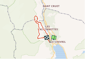

Length
12.1 km

Max alt
2210 m

Uphill gradient
762 m
Km-Effort
22 km

Min alt
1609 m

Downhill gradient
756 m
Boucle
Yes
Creation date :
2024-07-11 07:52:23.439
Updated on :
2024-07-11 12:40:01.469
4h46
Difficulty : Very difficult

FREE GPS app for hiking
 SityTrail
IGN / Geographical institutes
SityTrail Plus
The world is yours!
About
Trail Walking of 12.1 km to be discovered at Auvergne-Rhône-Alpes, Savoy, Tignes. This trail is proposed by jojo02.
Positioning
Country:
France
Region :
Auvergne-Rhône-Alpes
Department/Province :
Savoy
Municipality :
Tignes
Location:
Unknown
Start:(Dec)
Start:(UTM)
337690 ; 5040192 (32T) N.
Comments