


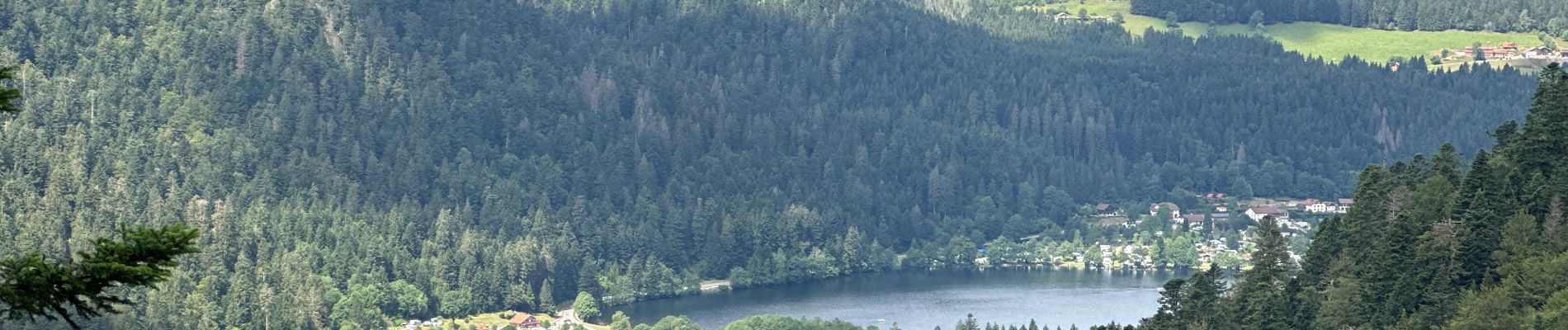
deuxième lac de Gerardmer

yves62410
User
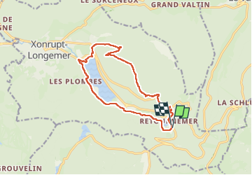

Length
14 km

Max alt
1087 m

Uphill gradient
499 m
Km-Effort
21 km

Min alt
733 m

Downhill gradient
498 m
Boucle
Yes
Creation date :
2024-07-17 08:44:16.0
Updated on :
2024-07-17 14:44:42.068
5h38
Difficulty : Difficult

FREE GPS app for hiking
 SityTrail
IGN / Geographical institutes
SityTrail Plus
The world is yours!
About
Trail Walking of 14 km to be discovered at Grand Est, Vosges, Xonrupt-Longemer. This trail is proposed by yves62410.
Description
Tour du lac, en passant par les sommets de la rive droite,
Attention à la parcelle dévalisé
Photos


Positioning
Country:
France
Region :
Grand Est
Department/Province :
Vosges
Municipality :
Xonrupt-Longemer
Location:
Unknown
Start:(Dec)
Start:(UTM)
350020 ; 5324462 (32U) N.
Comments