


2024 zap pré chaumette

ISAGIL
User
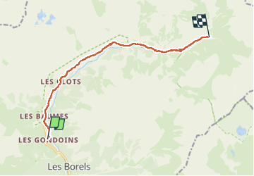

Length
10.3 km

Max alt
1828 m

Uphill gradient
577 m
Km-Effort
16.4 km

Min alt
1301 m

Downhill gradient
87 m
Boucle
No
Creation date :
2024-07-17 07:21:43.36
Updated on :
2024-07-20 07:43:52.017
3h39
Difficulty : Difficult

FREE GPS app for hiking
 SityTrail
IGN / Geographical institutes
SityTrail Plus
The world is yours!
About
Trail Walking of 10.3 km to be discovered at Provence-Alpes-Côte d'Azur, Hautes-Alpes, Champoléon. This trail is proposed by ISAGIL.
Description
pré chaumette
Positioning
Country:
France
Region :
Provence-Alpes-Côte d'Azur
Department/Province :
Hautes-Alpes
Municipality :
Champoléon
Location:
Unknown
Start:(Dec)
Start:(UTM)
282202 ; 4956622 (32T) N.
Comments