Trail Walking Le Port - Etang d'Arbu et pic des 3 seigneurs - Photo

Etang d'Arbu et pic des 3 seigneurs

 PhilB24
PhilB24

User

© OpenStreetMap contributors
Length
Length
11.3 km
Max alt
Max alt
2182 m
Uphill gradient
Uphill gradient
849 m
Km-Effort
Km-Effort  
23 km
Min alt
Min alt
1382 m
Downhill gradient
Downhill gradient
850 m
Boucle
Boucle
Yes
Creation date :
2024-07-21 07:43:55.039
Updated on :
2024-07-22 12:10:34.303

(0 Reviews)

Walking
Walking
5h08
Difficulty : Difficult

Scan this QR Code to open this trail in the SityTrail application

FREE GPS app for hiking

Logo SityTrail SityTrail

IGN / Geographical institutes

Download SityTrail from the App Store Download SityTrail from Google Play

Logo SityTrail SityTrail Plus

The world is yours!

Download SityTrail from the App Store Download SityTrail from Google Play Download SityTrail on Huawei AppGallery

About

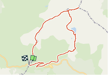
Trail Walking of 11.3 km to be discovered at Occitania, Ariège, Le Port. This trail is proposed by PhilB24.

Description

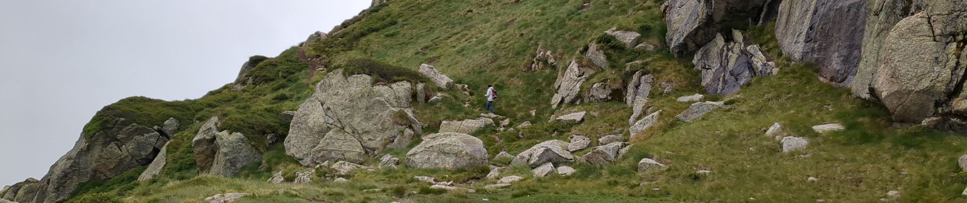
Parking Port de Lers. La partie au delà de l'étang demande parfois l'utilisation des mains. Moins de 45' pour monter au pic des 3 seigneurs depuis l'intersection. Les 800 m de descente peuvent être éprouvant pour les genoux suivant son entrainement. Pour nous ce sera sommet dans les nuages et pluie sur une partie de la descente. Dommage pour la vue!

Elevation profile

Photos

Positioning

Country:
France
Region :
Occitania
Department/Province :
Ariège
Municipality :
Le Port
Location:
Unknown
Start:(UTM)
370127 ; 4740551 (31T) N.


Close
My subscriptions