


Col de la Chipotte retour Etival

lorenzot54
User
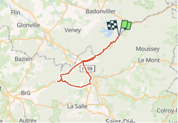

Length
47 km

Max alt
457 m

Uphill gradient
605 m
Km-Effort
55 km

Min alt
279 m

Downhill gradient
604 m
Boucle
Yes
Creation date :
2024-07-22 07:33:56.0
Updated on :
2024-07-22 11:21:04.305

FREE GPS app for hiking
 SityTrail
IGN / Geographical institutes
SityTrail Plus
The world is yours!
About
Trail of 47 km to be discovered at Grand Est, Meurthe-et-Moselle, Pierre-Percée. This trail is proposed by lorenzot54.
Positioning
Country:
France
Region :
Grand Est
Department/Province :
Meurthe-et-Moselle
Municipality :
Pierre-Percée
Location:
Unknown
Start:(Dec)
Start:(UTM)
348056 ; 5368770 (32U) N.
Comments