


Boucle d'Aubrac à St Chely d'Aubrac - 22 juil 24

morganee
User

Length
20 km

Max alt
1321 m

Uphill gradient
670 m
Km-Effort
29 km

Min alt
792 m

Downhill gradient
674 m
Boucle
Yes
Creation date :
2024-07-22 08:20:02.805
Updated on :
2024-07-22 16:20:21.042
7h00
Difficulty : Medium

FREE GPS app for hiking
 SityTrail
IGN / Geographical institutes
SityTrail Plus
The world is yours!
About
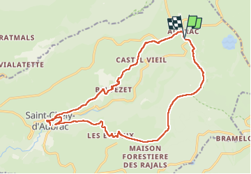
Trail Walking of 20 km to be discovered at Occitania, Aveyron, Saint-Chély-d'Aubrac. This trail is proposed by morganee.
Positioning
Country:
France
Region :
Occitania
Department/Province :
Aveyron
Municipality :
Saint-Chély-d'Aubrac
Location:
Unknown
Start:(Dec)
Start:(UTM)
499031 ; 4940692 (31T) N.
Comments