


col de joux plane

labarone
User
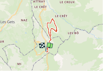

Length
10.5 km

Max alt
2011 m

Uphill gradient
723 m
Km-Effort
20 km

Min alt
1476 m

Downhill gradient
722 m
Boucle
Yes
Creation date :
2024-06-28 07:10:37.293
Updated on :
2024-07-23 13:43:25.067
6h09
Difficulty : Medium

FREE GPS app for hiking
 SityTrail
IGN / Geographical institutes
SityTrail Plus
The world is yours!
About
Trail Walking of 10.5 km to be discovered at Auvergne-Rhône-Alpes, Upper Savoy, Verchaix. This trail is proposed by labarone.
Description
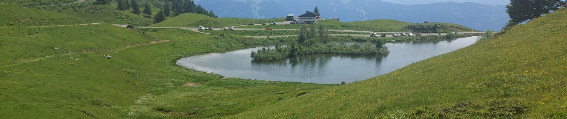
au debut longue côte pour arriver au sommet. Beau point de vue
Photos


Positioning
Country:
France
Region :
Auvergne-Rhône-Alpes
Department/Province :
Upper Savoy
Municipality :
Verchaix
Location:
Unknown
Start:(Dec)
Start:(UTM)
323050 ; 5111029 (32T) N.
Comments