Trail Walking Savines-le-Lac - boucle arnoud autour de savines  - Photo
 guariso
guariso

User

© OpenStreetMap contributors
Length
Length
7.1 km
Max alt
Max alt
988 m
Uphill gradient
Uphill gradient
287 m
Km-Effort
Km-Effort  
10.8 km
Min alt
Min alt
785 m
Downhill gradient
Downhill gradient
270 m
Boucle
Boucle
Yes
Creation date :
2024-07-24 08:05:01.059
Updated on :
2024-07-24 10:09:04.323

(0 Reviews)

Walking
Walking
1h38
Difficulty : Medium

Scan this QR Code to open this trail in the SityTrail application

FREE GPS app for hiking

Logo SityTrail SityTrail

IGN / Geographical institutes

Download SityTrail from the App Store Download SityTrail from Google Play

Logo SityTrail SityTrail Plus

The world is yours!

Download SityTrail from the App Store Download SityTrail from Google Play Download SityTrail on Huawei AppGallery

About

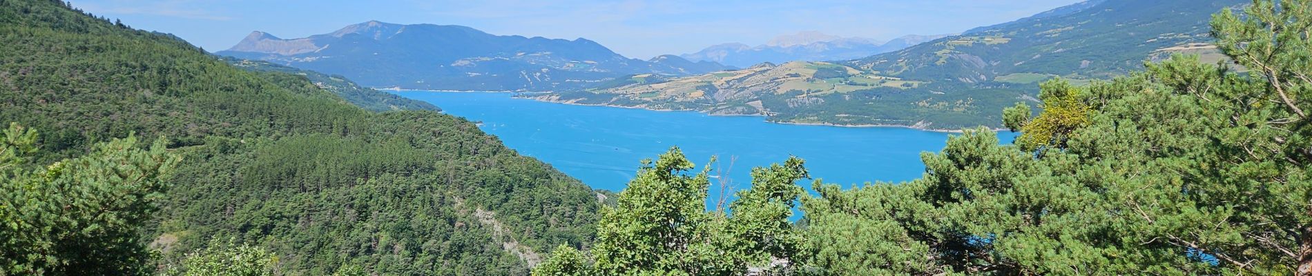
Trail Walking of 7.1 km to be discovered at Provence-Alpes-Côte d'Azur, Hautes-Alpes, Savines-le-Lac. This trail is proposed by guariso.

Description

Le départ peut se faire de n'importe où sur la boucle. C'est pour faire de la marche ou même nordique sur les portions forestières ou course à pieds pour les plus sportifs. Le long du lac est une portion plane qui emprunte le chemin piéton. Attention à la traversée pour aller sur le sentier pierre arnoux. Le sentier monte en sous bois. Jusqu'à la route forestière après 3 bifurcations à gauche puis une à droite. On redescend vers savines pas un petit sentier sur la gauche.

Elevation profile

Photos

Positioning

Country:
France
Region :
Provence-Alpes-Côte d'Azur
Department/Province :
Hautes-Alpes
Municipality :
Savines-le-Lac
Location:
Unknown
Start:(UTM)
292332 ; 4932835 (32T) N.


Close
My subscriptions