


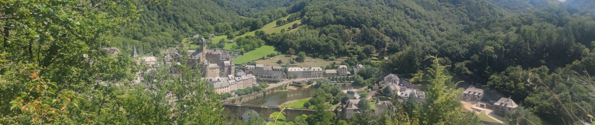
Boucle autour d'Estaing - 24 juil 2024

morganee
User
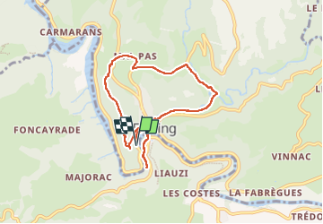

Length
8.2 km

Max alt
449 m

Uphill gradient
189 m
Km-Effort
10.7 km

Min alt
312 m

Downhill gradient
189 m
Boucle
Yes
Creation date :
2024-07-24 10:02:09.132
Updated on :
2024-07-24 13:58:01.447
3h00
Difficulty : Easy

FREE GPS app for hiking
 SityTrail
IGN / Geographical institutes
SityTrail Plus
The world is yours!
About
Trail Walking of 8.2 km to be discovered at Occitania, Aveyron, Estaing. This trail is proposed by morganee.
Photos

Positioning
Country:
France
Region :
Occitania
Department/Province :
Aveyron
Municipality :
Estaing
Location:
Unknown
Start:(Dec)
Start:(UTM)
473783 ; 4933167 (31T) N.
Comments