


l'olivier

Pascal-83
User
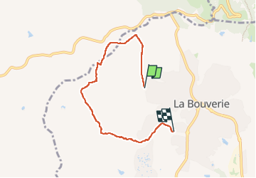

Length
5.8 km

Max alt
113 m

Uphill gradient
78 m
Km-Effort
6.8 km

Min alt
32 m

Downhill gradient
93 m
Boucle
No
Creation date :
2024-07-25 05:58:40.839
Updated on :
2024-07-25 08:01:23.877
2h02
Difficulty : Very easy

FREE GPS app for hiking
 SityTrail
IGN / Geographical institutes
SityTrail Plus
The world is yours!
About
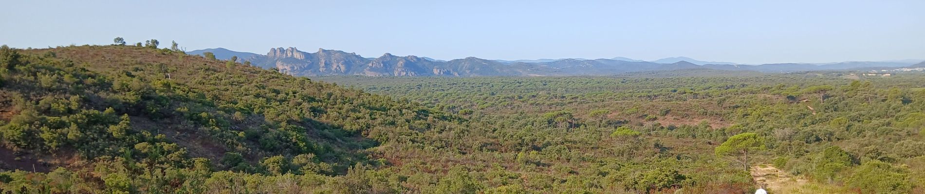
Trail Walking of 5.8 km to be discovered at Provence-Alpes-Côte d'Azur, Var, Roquebrune-sur-Argens. This trail is proposed by Pascal-83.
Description
Marche d'été
Photos

Positioning
Country:
France
Region :
Provence-Alpes-Côte d'Azur
Department/Province :
Var
Municipality :
Roquebrune-sur-Argens
Location:
Unknown
Start:(Dec)
Start:(UTM)
308448 ; 4819481 (32T) N.
Comments