


Iles aux mpines

raygautier
User
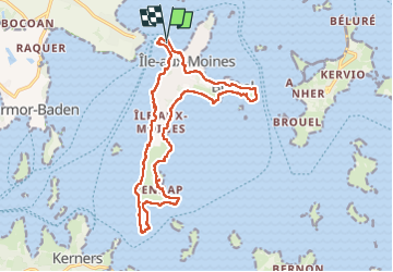

Length
17.4 km

Max alt
22 m

Uphill gradient
153 m
Km-Effort
19.5 km

Min alt
-2 m

Downhill gradient
158 m
Boucle
Yes
Creation date :
2024-07-25 07:17:30.0
Updated on :
2024-07-25 16:03:59.179

FREE GPS app for hiking
 SityTrail
IGN / Geographical institutes
SityTrail Plus
The world is yours!
About
Trail of 17.4 km to be discovered at Brittany, Morbihan, Île-aux-Moines. This trail is proposed by raygautier.
Positioning
Country:
France
Region :
Brittany
Department/Province :
Morbihan
Municipality :
Île-aux-Moines
Location:
Unknown
Start:(Dec)
Start:(UTM)
511096 ; 5271948 (30T) N.
Comments