


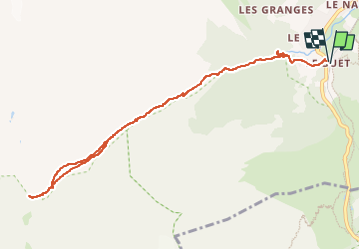
Le Buet - refuge de la Pierre à Bérard deniv +600m

jeanmarcMasson
User GUIDE

Length
10.8 km

Max alt
1927 m

Uphill gradient
605 m
Km-Effort
18.9 km

Min alt
1344 m

Downhill gradient
605 m
Boucle
Yes
Creation date :
2024-07-26 09:21:59.729
Updated on :
2024-07-26 10:06:29.615
4h17
Difficulty : Difficult

FREE GPS app for hiking
 SityTrail
IGN / Geographical institutes
SityTrail Plus
The world is yours!
About
Trail Walking of 10.8 km to be discovered at Auvergne-Rhône-Alpes, Upper Savoy, Vallorcine. This trail is proposed by jeanmarcMasson.
Positioning
Country:
France
Region :
Auvergne-Rhône-Alpes
Department/Province :
Upper Savoy
Municipality :
Vallorcine
Location:
Unknown
Start:(Dec)
Start:(UTM)
339027 ; 5098268 (32T) N.
Comments