


lac St apollinaire . Realon / retour

stef789
User GUIDE
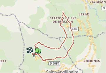

Length
9.3 km

Max alt
1650 m

Uphill gradient
334 m
Km-Effort
13.7 km

Min alt
1396 m

Downhill gradient
331 m
Boucle
Yes
Creation date :
2024-07-30 09:07:16.039
Updated on :
2024-07-30 12:41:01.596
2h50
Difficulty : Easy

FREE GPS app for hiking
 SityTrail
IGN / Geographical institutes
SityTrail Plus
The world is yours!
About
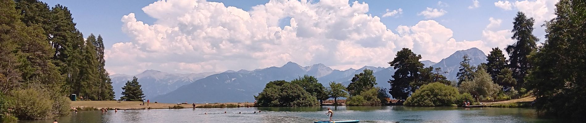
Trail Walking of 9.3 km to be discovered at Provence-Alpes-Côte d'Azur, Hautes-Alpes, Saint-Apollinaire. This trail is proposed by stef789.
Photos


27 photos in total. Please click on a photo to see them all in the gallery.
Positioning
Country:
France
Region :
Provence-Alpes-Côte d'Azur
Department/Province :
Hautes-Alpes
Municipality :
Saint-Apollinaire
Location:
Unknown
Start:(Dec)
Start:(UTM)
289260 ; 4937655 (32T) N.
Comments