


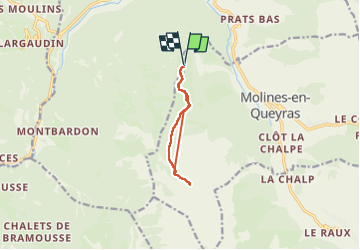
vallée de la pointe de Rasis au départ de sommet Bucher

PhilippeCORTES
User

Length
8.4 km

Max alt
2376 m

Uphill gradient
400 m
Km-Effort
13.7 km

Min alt
2142 m

Downhill gradient
404 m
Boucle
Yes
Creation date :
2024-07-30 08:24:49.443
Updated on :
2024-07-30 13:10:08.51
2h12
Difficulty : Difficult

FREE GPS app for hiking
 SityTrail
IGN / Geographical institutes
SityTrail Plus
The world is yours!
About
Trail Walking of 8.4 km to be discovered at Provence-Alpes-Côte d'Azur, Hautes-Alpes, Château-Ville-Vieille. This trail is proposed by PhilippeCORTES.
Positioning
Country:
France
Region :
Provence-Alpes-Côte d'Azur
Department/Province :
Hautes-Alpes
Municipality :
Château-Ville-Vieille
Location:
Unknown
Start:(Dec)
Start:(UTM)
326891 ; 4956346 (32T) N.
Comments