


Source de Bonnefont

sypat
User

Length
3.9 km

Max alt
916 m

Uphill gradient
178 m
Km-Effort
6.2 km

Min alt
739 m

Downhill gradient
179 m
Boucle
Yes
Creation date :
2024-07-31 10:08:18.824
Updated on :
2024-07-31 14:10:45.881
1h30
Difficulty : Medium

FREE GPS app for hiking
 SityTrail
IGN / Geographical institutes
SityTrail Plus
The world is yours!
About
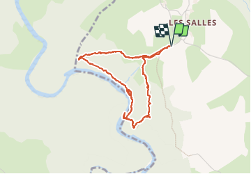
Trail Walking of 3.9 km to be discovered at Auvergne-Rhône-Alpes, Haute-Loire, Saint-Martin-de-Fugères. This trail is proposed by sypat.
Photos


Positioning
Country:
France
Region :
Auvergne-Rhône-Alpes
Department/Province :
Haute-Loire
Municipality :
Saint-Martin-de-Fugères
Location:
Unknown
Start:(Dec)
Start:(UTM)
572796 ; 4974939 (31T) N.
Comments