


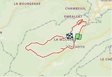
elbpierre 2024 le cirque

jacquesduchesne
User

Length
18.3 km

Max alt
1445 m

Uphill gradient
659 m
Km-Effort
27 km

Min alt
983 m

Downhill gradient
662 m
Boucle
Yes
Creation date :
2024-07-31 06:57:54.898
Updated on :
2024-07-31 15:10:00.392
8h10
Difficulty : Very difficult

FREE GPS app for hiking
 SityTrail
IGN / Geographical institutes
SityTrail Plus
The world is yours!
About
Trail Walking of 18.3 km to be discovered at Auvergne-Rhône-Alpes, Cantal, Albepierre-Bredons. This trail is proposed by jacquesduchesne.
Positioning
Country:
France
Region :
Auvergne-Rhône-Alpes
Department/Province :
Cantal
Municipality :
Albepierre-Bredons
Location:
Unknown
Start:(Dec)
Start:(UTM)
486799 ; 4991696 (31T) N.
Comments