


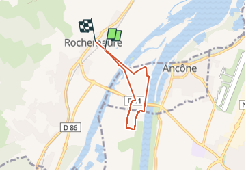
rochemaure et via rhona

Jerry Vanhemelen
User

Length
4.8 km

Max alt
83 m

Uphill gradient
45 m
Km-Effort
5.4 km

Min alt
68 m

Downhill gradient
45 m
Boucle
No
Creation date :
2024-08-02 08:28:39.916
Updated on :
2024-08-02 10:15:45.111
1h46
Difficulty : Easy

FREE GPS app for hiking
 SityTrail
IGN / Geographical institutes
SityTrail Plus
The world is yours!
About
Trail Walking of 4.8 km to be discovered at Auvergne-Rhône-Alpes, Ardèche, Rochemaure. This trail is proposed by Jerry Vanhemelen.
Positioning
Country:
France
Region :
Auvergne-Rhône-Alpes
Department/Province :
Ardèche
Municipality :
Rochemaure
Location:
Unknown
Start:(Dec)
Start:(UTM)
635460 ; 4938378 (31T) N.
Comments