


La Flegere - Planpraz

jeanmarcMasson
User GUIDE

Length
5.7 km

Max alt
2072 m

Uphill gradient
330 m
Km-Effort
9.6 km

Min alt
1810 m

Downhill gradient
169 m
Boucle
No
Creation date :
2024-08-06 08:46:04.954
Updated on :
2024-08-06 12:55:23.384
2h43
Difficulty : Medium

FREE GPS app for hiking
 SityTrail
IGN / Geographical institutes
SityTrail Plus
The world is yours!
About
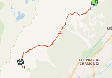
Trail Walking of 5.7 km to be discovered at Auvergne-Rhône-Alpes, Upper Savoy, Chamonix-Mont-Blanc. This trail is proposed by jeanmarcMasson.
Positioning
Country:
France
Region :
Auvergne-Rhône-Alpes
Department/Province :
Upper Savoy
Municipality :
Chamonix-Mont-Blanc
Location:
Unknown
Start:(Dec)
Start:(UTM)
336270 ; 5091846 (32T) N.
Comments