


Circuit 2

PhilippeC54
User

Length
65 km

Max alt
698 m

Uphill gradient
1096 m
Km-Effort
80 km

Min alt
313 m

Downhill gradient
1096 m
Boucle
Yes
Creation date :
2024-08-04 07:17:42.103
Updated on :
2024-08-07 06:19:07.218
3h50
Difficulty : Difficult

FREE GPS app for hiking
 SityTrail
IGN / Geographical institutes
SityTrail Plus
The world is yours!
About
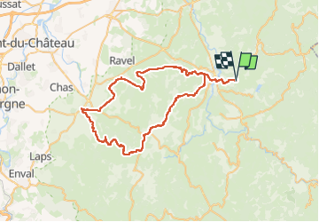
Trail Road bike of 65 km to be discovered at Auvergne-Rhône-Alpes, Puy-de-Dôme, Aubusson-d'Auvergne. This trail is proposed by PhilippeC54.
Positioning
Country:
France
Region :
Auvergne-Rhône-Alpes
Department/Province :
Puy-de-Dôme
Municipality :
Aubusson-d'Auvergne
Location:
Unknown
Start:(Dec)
Start:(UTM)
544640 ; 5067040 (31T) N.
Comments