


zap août 2024 girmont

ISAGIL
User
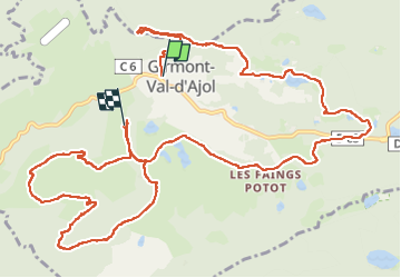

Length
15.8 km

Max alt
747 m

Uphill gradient
467 m
Km-Effort
22 km

Min alt
496 m

Downhill gradient
435 m
Boucle
No
Creation date :
2024-08-07 07:59:23.549
Updated on :
2024-08-07 14:57:28.182
4h43
Difficulty : Very difficult

FREE GPS app for hiking
 SityTrail
IGN / Geographical institutes
SityTrail Plus
The world is yours!
About
Trail Walking of 15.8 km to be discovered at Grand Est, Vosges, Girmont-Val-d'Ajol. This trail is proposed by ISAGIL.
Description
rando girmont
Positioning
Country:
France
Region :
Grand Est
Department/Province :
Vosges
Municipality :
Girmont-Val-d'Ajol
Location:
Unknown
Start:(Dec)
Start:(UTM)
317780 ; 5314148 (32T) N.
Comments