


rikiki rando du lac Siguret

stef789
User GUIDE
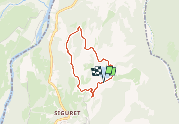

Length
3.3 km

Max alt
1127 m

Uphill gradient
71 m
Km-Effort
4.2 km

Min alt
1060 m

Downhill gradient
69 m
Boucle
Yes
Creation date :
2024-08-07 16:14:01.98
Updated on :
2024-08-07 19:31:18.379
58m
Difficulty : Very easy

FREE GPS app for hiking
 SityTrail
IGN / Geographical institutes
SityTrail Plus
The world is yours!
About
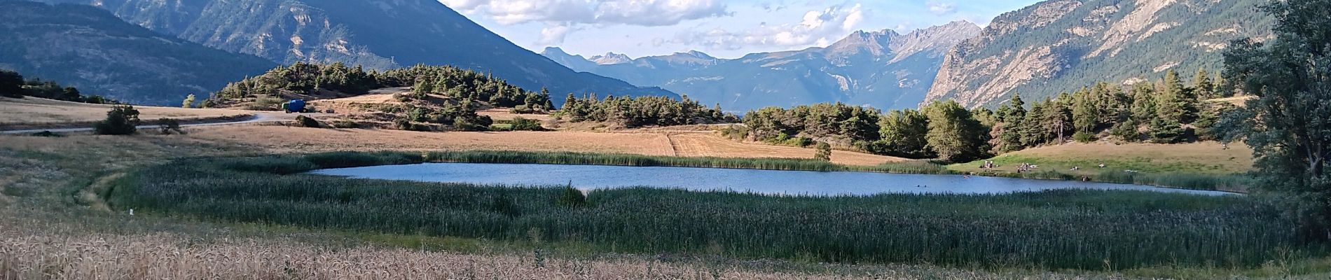
Trail Walking of 3.3 km to be discovered at Provence-Alpes-Côte d'Azur, Hautes-Alpes, Saint-André-d'Embrun. This trail is proposed by stef789.
Photos


24 photos in total. Please click on a photo to see them all in the gallery.
Positioning
Country:
France
Region :
Provence-Alpes-Côte d'Azur
Department/Province :
Hautes-Alpes
Municipality :
Saint-André-d'Embrun
Location:
Unknown
Start:(Dec)
Start:(UTM)
306156 ; 4942857 (32T) N.
Comments