


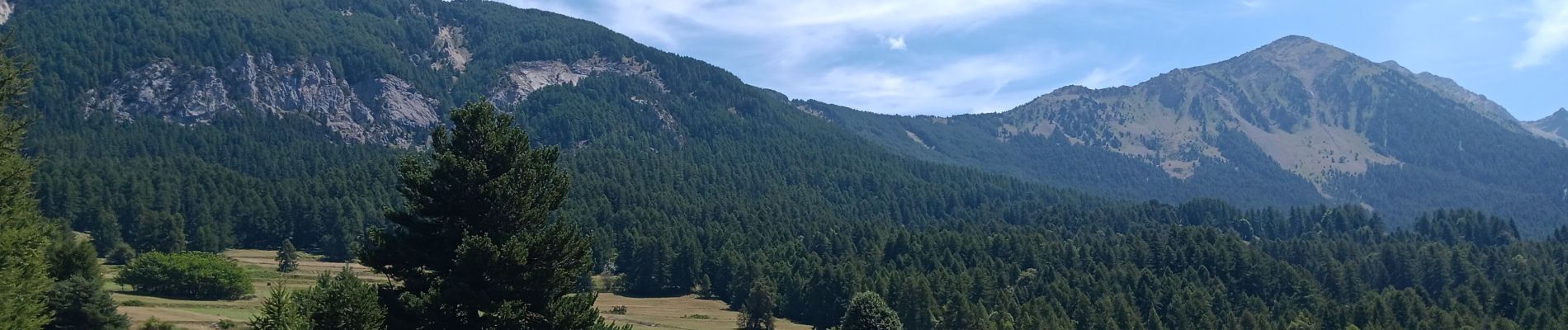
boucle du lac Lauzerot depuis Gendre

stef789
User GUIDE
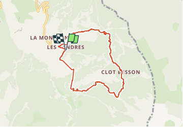

Length
7.8 km

Max alt
1950 m

Uphill gradient
445 m
Km-Effort
13.7 km

Min alt
1563 m

Downhill gradient
447 m
Boucle
Yes
Creation date :
2024-08-08 11:00:03.008
Updated on :
2024-08-08 14:41:24.348
3h40
Difficulty : Easy

FREE GPS app for hiking
 SityTrail
IGN / Geographical institutes
SityTrail Plus
The world is yours!
About
Trail Walking of 7.8 km to be discovered at Provence-Alpes-Côte d'Azur, Hautes-Alpes, Crots. This trail is proposed by stef789.
Photos


28 photos in total. Please click on a photo to see them all in the gallery.
Positioning
Country:
France
Region :
Provence-Alpes-Côte d'Azur
Department/Province :
Hautes-Alpes
Municipality :
Crots
Location:
Unknown
Start:(Dec)
Start:(UTM)
299578 ; 4929461 (32T) N.
Comments