


Aouste Léoncel Barbieres 93km

thonyc
User GUIDE
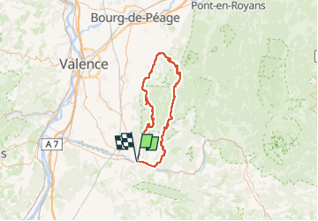

Length
93 km

Max alt
1147 m

Uphill gradient
2047 m
Km-Effort
120 km

Min alt
203 m

Downhill gradient
2047 m
Boucle
Yes
Creation date :
2024-08-10 07:45:37.16
Updated on :
2024-08-21 18:22:29.163
7h16
Difficulty : Very difficult

FREE GPS app for hiking
 SityTrail
IGN / Geographical institutes
SityTrail Plus
The world is yours!
About
Trail Road bike of 93 km to be discovered at Auvergne-Rhône-Alpes, Drôme, Aouste-sur-Sye. This trail is proposed by thonyc.
Positioning
Country:
France
Region :
Auvergne-Rhône-Alpes
Department/Province :
Drôme
Municipality :
Aouste-sur-Sye
Location:
Unknown
Start:(Dec)
Start:(UTM)
663152 ; 4953434 (31T) N.
Comments