


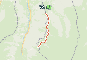
Rando Col de la Coume

cl56
User

Length
5.6 km

Max alt
1771 m

Uphill gradient
351 m
Km-Effort
10.3 km

Min alt
1466 m

Downhill gradient
352 m
Boucle
Yes
Creation date :
2024-08-13 11:22:46.683
Updated on :
2024-08-13 14:57:43.431
3h04
Difficulty : Medium

FREE GPS app for hiking
 SityTrail
IGN / Geographical institutes
SityTrail Plus
The world is yours!
About
Trail Walking of 5.6 km to be discovered at Occitania, Haute-Garonne, Oô. This trail is proposed by cl56.
Description
Col de la Coume _ Coume de Jugnet
3h de marche
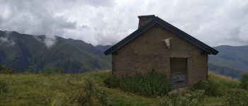
Photos

Positioning
Country:
France
Region :
Occitania
Department/Province :
Haute-Garonne
Municipality :
Oô
Location:
Unknown
Start:(Dec)
Start:(UTM)
297019 ; 4740086 (31T) N.
Comments