


Canal Roanne Digoin 2024

bena42
User

Length
25 km

Max alt
279 m

Uphill gradient
151 m
Km-Effort
27 km

Min alt
255 m

Downhill gradient
161 m
Boucle
No
Creation date :
2024-08-14 07:33:36.843
Updated on :
2024-08-14 07:34:20.398
1h52
Difficulty : Medium

FREE GPS app for hiking
 SityTrail
IGN / Geographical institutes
SityTrail Plus
The world is yours!
About
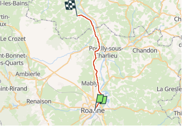
Trail Mountain bike of 25 km to be discovered at Auvergne-Rhône-Alpes, Loire, Roanne. This trail is proposed by bena42.
Positioning
Country:
France
Region :
Auvergne-Rhône-Alpes
Department/Province :
Loire
Municipality :
Roanne
Location:
Unknown
Start:(Dec)
Start:(UTM)
583516 ; 5098448 (31T) N.
Comments