


Chemin de Bélizar

sebastienu
User
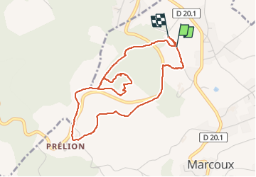

Length
4.8 km

Max alt
595 m

Uphill gradient
154 m
Km-Effort
6.8 km

Min alt
471 m

Downhill gradient
157 m
Boucle
Yes
Creation date :
2024-08-14 15:52:29.402
Updated on :
2024-08-14 17:43:16.272
1h49
Difficulty : Easy

FREE GPS app for hiking
 SityTrail
IGN / Geographical institutes
SityTrail Plus
The world is yours!
About
Trail Walking of 4.8 km to be discovered at Auvergne-Rhône-Alpes, Loire, Marcoux. This trail is proposed by sebastienu.
Description
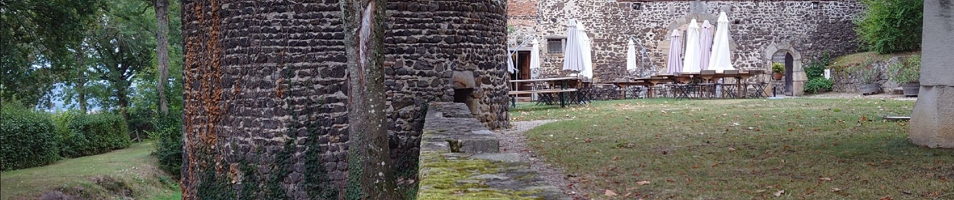
Autour du château de Goutelas, les bornes culturelles content les amours de Céladon, la géologie et les produits locaux (vins du Forez et eau pétillante)
Photos

Positioning
Country:
France
Region :
Auvergne-Rhône-Alpes
Department/Province :
Loire
Municipality :
Marcoux
Location:
Unknown
Start:(Dec)
Start:(UTM)
578528 ; 5063592 (31T) N.
Comments