


saint walfroy 17.08.2024

jcb48
User
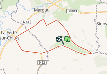

Length
8 km

Max alt
353 m

Uphill gradient
192 m
Km-Effort
10.5 km

Min alt
169 m

Downhill gradient
191 m
Boucle
Yes
Creation date :
2024-08-15 18:48:48.184
Updated on :
2024-08-15 18:50:34.924
2h23
Difficulty : Easy

FREE GPS app for hiking
 SityTrail
IGN / Geographical institutes
SityTrail Plus
The world is yours!
About
Trail On foot of 8 km to be discovered at Grand Est, Ardennes, Margut. This trail is proposed by jcb48.
Description
randonnee
Positioning
Country:
France
Region :
Grand Est
Department/Province :
Ardennes
Municipality :
Margut
Location:
Unknown
Start:(Dec)
Start:(UTM)
664333 ; 5493362 (31U) N.
Comments