


de Kerbader à Mousterlin

ymarvin27
User

Length
7.5 km

Max alt
15 m

Uphill gradient
28 m
Km-Effort
7.8 km

Min alt
1 m

Downhill gradient
27 m
Boucle
Yes
Creation date :
2015-05-03 00:00:00.0
Updated on :
2015-05-03 00:00:00.0
1h49
Difficulty : Easy

FREE GPS app for hiking
 SityTrail
IGN / Geographical institutes
SityTrail Plus
The world is yours!
About
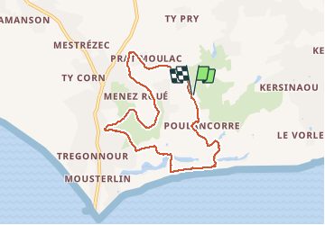
Trail Walking of 7.5 km to be discovered at Brittany, Finistère, Fouesnant. This trail is proposed by ymarvin27.
Description
départ chapelle de kerbader. Fouesnant direction Mousterlin puis chapelle. sans balisage.
Photos


Positioning
Country:
France
Region :
Brittany
Department/Province :
Finistère
Municipality :
Fouesnant
Location:
Unknown
Start:(Dec)
Start:(UTM)
423534 ; 5301282 (30T) N.
Comments