


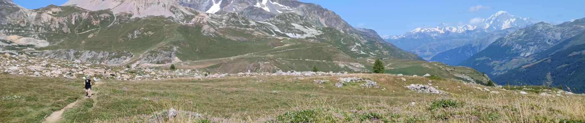
240816 - Tignes - Tignes-CombeFolle

randodan
User
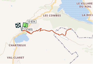

Length
7.5 km

Max alt
2278 m

Uphill gradient
308 m
Km-Effort
11.6 km

Min alt
2085 m

Downhill gradient
307 m
Boucle
Yes
Creation date :
2024-08-16 07:15:36.432
Updated on :
2024-08-16 11:26:05.85
4h09
Difficulty : Medium

FREE GPS app for hiking
 SityTrail
IGN / Geographical institutes
SityTrail Plus
The world is yours!
About
Trail Walking of 7.5 km to be discovered at Auvergne-Rhône-Alpes, Savoy, Tignes. This trail is proposed by randodan.
Photos


Positioning
Country:
France
Region :
Auvergne-Rhône-Alpes
Department/Province :
Savoy
Municipality :
Tignes
Location:
Unknown
Start:(Dec)
Start:(UTM)
336178 ; 5037173 (32T) N.
Comments