


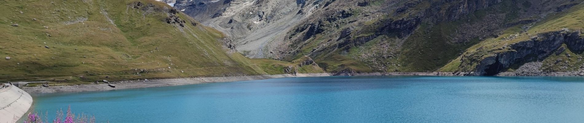
240819 - Tignes - BgeSaut-LacSassière

randodan
User
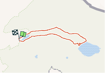

Length
7.6 km

Max alt
2474 m

Uphill gradient
220 m
Km-Effort
10.6 km

Min alt
2279 m

Downhill gradient
221 m
Boucle
Yes
Creation date :
2024-08-19 09:04:08.481
Updated on :
2024-08-19 15:19:22.298
5h19
Difficulty : Easy

FREE GPS app for hiking
 SityTrail
IGN / Geographical institutes
SityTrail Plus
The world is yours!
About
Trail Walking of 7.6 km to be discovered at Auvergne-Rhône-Alpes, Savoy, Tignes. This trail is proposed by randodan.
Photos


Positioning
Country:
France
Region :
Auvergne-Rhône-Alpes
Department/Province :
Savoy
Municipality :
Tignes
Location:
Unknown
Start:(Dec)
Start:(UTM)
341150 ; 5038914 (32T) N.
Comments