


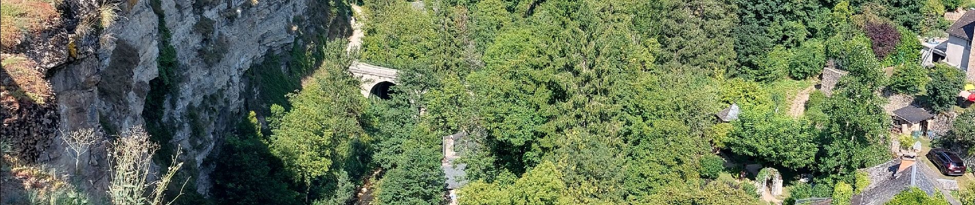
Bozouls

Nathalie. Mercier
User
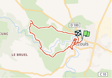

Length
9.7 km

Max alt
552 m

Uphill gradient
257 m
Km-Effort
13.1 km

Min alt
429 m

Downhill gradient
257 m
Boucle
Yes
Creation date :
2024-08-19 11:52:04.364
Updated on :
2024-08-19 15:27:12.198
2h35
Difficulty : Easy

FREE GPS app for hiking
 SityTrail
IGN / Geographical institutes
SityTrail Plus
The world is yours!
About
Trail Walking of 9.7 km to be discovered at Occitania, Aveyron, Bozouls. This trail is proposed by Nathalie. Mercier.
Photos


Positioning
Country:
France
Region :
Occitania
Department/Province :
Aveyron
Municipality :
Bozouls
Location:
Unknown
Start:(Dec)
Start:(UTM)
477908 ; 4924202 (31T) N.
Comments