


2024 08 Varenne t1

michel1025
User
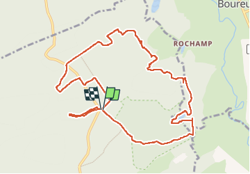

Length
11.4 km

Max alt
270 m

Uphill gradient
211 m
Km-Effort
14.2 km

Min alt
172 m

Downhill gradient
213 m
Boucle
Yes
Creation date :
2024-08-20 11:52:37.0
Updated on :
2024-08-21 10:53:02.06
3h15
Difficulty : Difficult

FREE GPS app for hiking
 SityTrail
IGN / Geographical institutes
SityTrail Plus
The world is yours!
About
Trail Walking of 11.4 km to be discovered at Grand Est, Meuse, Lachalade. This trail is proposed by michel1025.
Positioning
Country:
France
Region :
Grand Est
Department/Province :
Meuse
Municipality :
Lachalade
Location:
Unknown
Start:(Dec)
Start:(UTM)
646317 ; 5449443 (31U) N.
Comments