


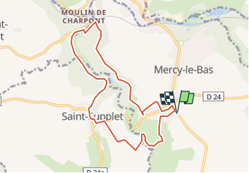
mercy le bas 22.08.2024

jcb48
User

Length
8.4 km

Max alt
308 m

Uphill gradient
145 m
Km-Effort
10.3 km

Min alt
250 m

Downhill gradient
145 m
Boucle
Yes
Creation date :
2024-08-21 12:31:05.363
Updated on :
2024-08-21 12:32:13.123
2h20
Difficulty : Easy

FREE GPS app for hiking
 SityTrail
IGN / Geographical institutes
SityTrail Plus
The world is yours!
About
Trail On foot of 8.4 km to be discovered at Grand Est, Meurthe-et-Moselle, Mercy-le-Bas. This trail is proposed by jcb48.
Description
randonnee
Positioning
Country:
France
Region :
Grand Est
Department/Province :
Meurthe-et-Moselle
Municipality :
Mercy-le-Bas
Location:
Unknown
Start:(Dec)
Start:(UTM)
700039 ; 5473686 (31U) N.
Comments