


240821 - Tignes - leMonal via St Foy et ... chenal

randodan
User
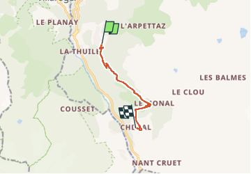

Length
7.4 km

Max alt
1888 m

Uphill gradient
339 m
Km-Effort
11.5 km

Min alt
1572 m

Downhill gradient
213 m
Boucle
No
Creation date :
2024-08-21 09:25:47.081
Updated on :
2024-08-21 14:55:55.042
5h29
Difficulty : Medium

FREE GPS app for hiking
 SityTrail
IGN / Geographical institutes
SityTrail Plus
The world is yours!
About
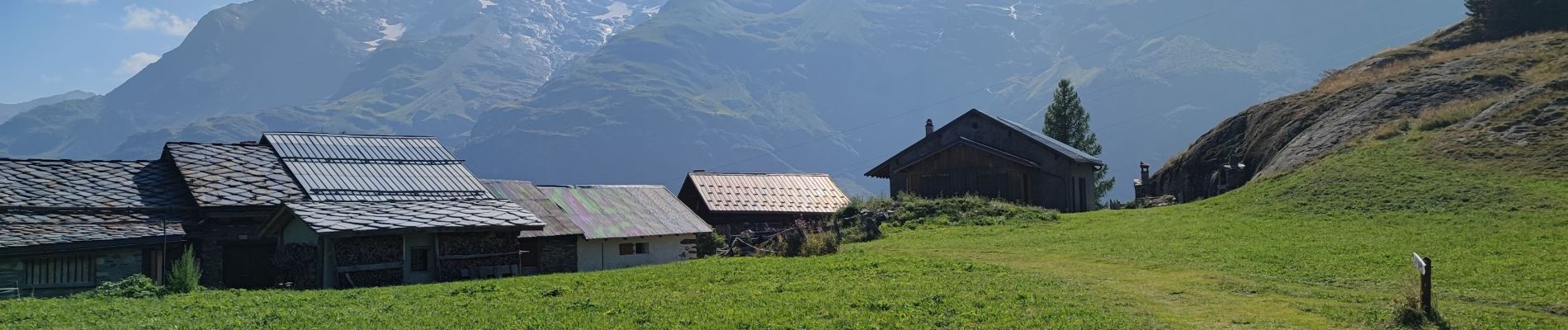
Trail Walking of 7.4 km to be discovered at Auvergne-Rhône-Alpes, Savoy, Sainte-Foy-Tarentaise. This trail is proposed by randodan.
Photos


Positioning
Country:
France
Region :
Auvergne-Rhône-Alpes
Department/Province :
Savoy
Municipality :
Sainte-Foy-Tarentaise
Location:
Unknown
Start:(Dec)
Start:(UTM)
335901 ; 5049023 (32T) N.
Comments