


La Lunette n°2 courte

okfred26
User
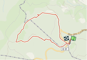

Length
5.3 km

Max alt
1320 m

Uphill gradient
210 m
Km-Effort
8.1 km

Min alt
1197 m

Downhill gradient
209 m
Boucle
Yes
Creation date :
2024-08-21 15:25:22.336
Updated on :
2024-08-21 15:24:43.876
1h50
Difficulty : Medium

FREE GPS app for hiking
 SityTrail
IGN / Geographical institutes
SityTrail Plus
The world is yours!
About
Trail Walking of 5.3 km to be discovered at Auvergne-Rhône-Alpes, Isère, Malleval-en-Vercors. This trail is proposed by okfred26.
Positioning
Country:
France
Region :
Auvergne-Rhône-Alpes
Department/Province :
Isère
Municipality :
Malleval-en-Vercors
Location:
Unknown
Start:(Dec)
Start:(UTM)
691484 ; 5000339 (31T) N.
Comments