


2024-08-23_16h09m08_Les_belvederes_de_Chauzon

raab
User
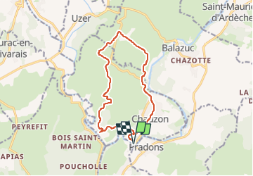

Length
13.9 km

Max alt
264 m

Uphill gradient
279 m
Km-Effort
17.6 km

Min alt
131 m

Downhill gradient
275 m
Boucle
Yes
Creation date :
2024-08-23 14:09:08.172
Updated on :
2024-08-23 14:11:44.877
3h59
Difficulty : Difficult

FREE GPS app for hiking
 SityTrail
IGN / Geographical institutes
SityTrail Plus
The world is yours!
About
Trail Walking of 13.9 km to be discovered at Auvergne-Rhône-Alpes, Ardèche, Chauzon. This trail is proposed by raab.
Positioning
Country:
France
Region :
Auvergne-Rhône-Alpes
Department/Province :
Ardèche
Municipality :
Chauzon
Location:
Unknown
Start:(Dec)
Start:(UTM)
607467 ; 4925596 (31T) N.
Comments