


GR34-9 Audierne Plogoff 19km

thonyc
User GUIDE
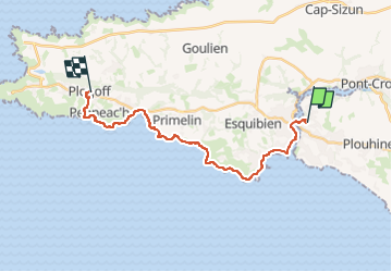

Length
19 km

Max alt
68 m

Uphill gradient
224 m
Km-Effort
22 km

Min alt
-4 m

Downhill gradient
209 m
Boucle
No
Creation date :
2024-08-29 09:30:47.168
Updated on :
2024-08-29 09:32:38.894
4h58
Difficulty : Medium

FREE GPS app for hiking
 SityTrail
IGN / Geographical institutes
SityTrail Plus
The world is yours!
About
Trail Walking of 19 km to be discovered at Brittany, Finistère, Plouhinec. This trail is proposed by thonyc.
Positioning
Country:
France
Region :
Brittany
Department/Province :
Finistère
Municipality :
Plouhinec
Location:
Unknown
Start:(Dec)
Start:(UTM)
386022 ; 5320151 (30U) N.
Comments