


Uxegney

randolea
User
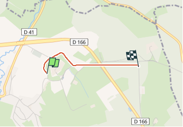

Length
1.5 km

Max alt
385 m

Uphill gradient
25 m
Km-Effort
1.7 km

Min alt
365 m

Downhill gradient
9 m
Boucle
No
Creation date :
2024-09-01 07:39:24.723
Updated on :
2024-09-01 09:24:21.093
8m
Difficulty : Easy

FREE GPS app for hiking
 SityTrail
IGN / Geographical institutes
SityTrail Plus
The world is yours!
About
Trail Walking of 1.5 km to be discovered at Grand Est, Vosges, Uxegney. This trail is proposed by randolea.
Positioning
Country:
France
Region :
Grand Est
Department/Province :
Vosges
Municipality :
Uxegney
Location:
Unknown
Start:(Dec)
Start:(UTM)
305533 ; 5342001 (32U) N.
Comments