


Forêt de Brou - Croix et Ruisseau 2010-07-21

gael.simon
User
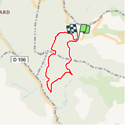

Length
5.2 km

Max alt
653 m

Uphill gradient
217 m
Km-Effort
8.1 km

Min alt
458 m

Downhill gradient
218 m
Boucle
Yes
Creation date :
2014-12-10 00:00:00.0
Updated on :
2014-12-10 00:00:00.0
--
Difficulty : Unknown

FREE GPS app for hiking
 SityTrail
IGN / Geographical institutes
SityTrail Plus
The world is yours!
About
Trail Walking of 5.2 km to be discovered at Auvergne-Rhône-Alpes, Rhône, Ternand. This trail is proposed by gael.simon.
Photos


Points of interest


Positioning
Country:
France
Region :
Auvergne-Rhône-Alpes
Department/Province :
Rhône
Municipality :
Ternand
Location:
Unknown
Start:(Dec)
Start:(UTM)
615784 ; 5089485 (31T) N.
Comments