


MARGERIAZ-02-08-24

papou73
User

Length
6.1 km

Max alt
1748 m

Uphill gradient
361 m
Km-Effort
10.9 km

Min alt
1384 m

Downhill gradient
357 m
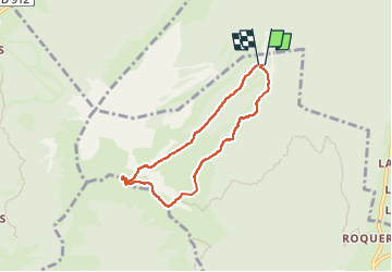
Boucle
Yes
Creation date :
2024-09-02 06:45:36.591
Updated on :
2024-09-03 11:44:43.384
2h27
Difficulty : Medium

FREE GPS app for hiking
 SityTrail
IGN / Geographical institutes
SityTrail Plus
The world is yours!
About
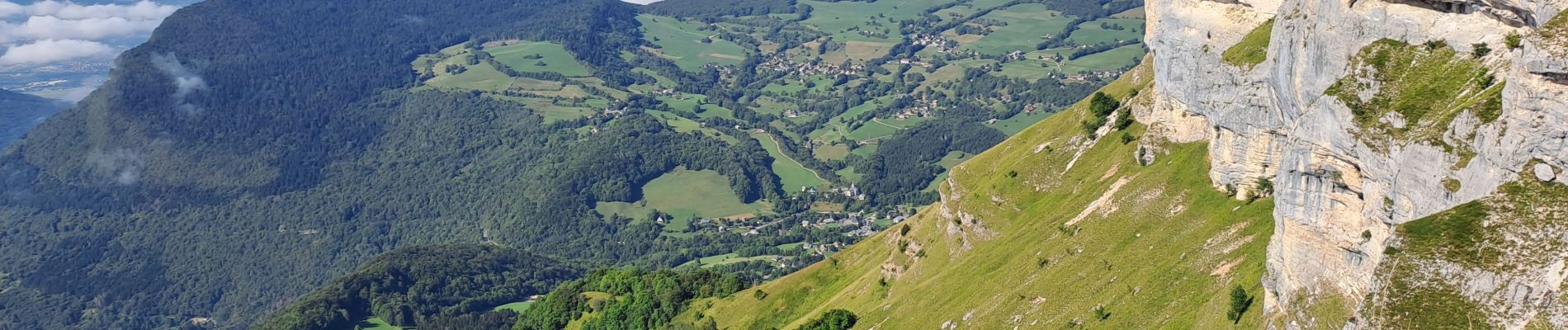
Trail Walking of 6.1 km to be discovered at Auvergne-Rhône-Alpes, Savoy, Aillon-le-Jeune. This trail is proposed by papou73.
Photos


Positioning
Country:
France
Region :
Auvergne-Rhône-Alpes
Department/Province :
Savoy
Municipality :
Aillon-le-Jeune
Location:
Unknown
Start:(Dec)
Start:(UTM)
271115 ; 5058545 (32T) N.
Comments