


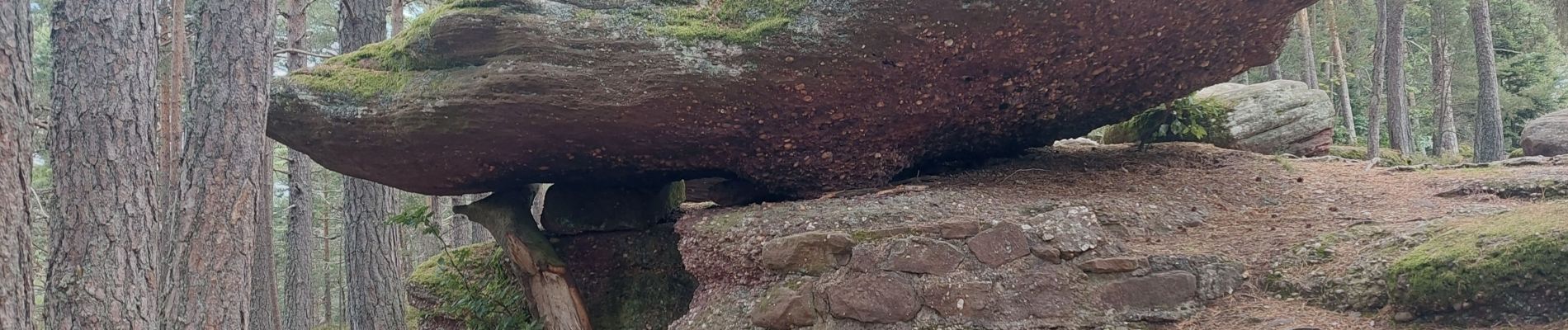
col de wettstein la pierre tremblante

lemuid
User
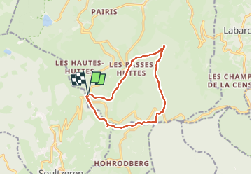

Length
11.4 km

Max alt
1013 m

Uphill gradient
398 m
Km-Effort
16.7 km

Min alt
678 m

Downhill gradient
396 m
Boucle
Yes
Creation date :
2024-09-02 07:13:10.532
Updated on :
2024-09-02 12:32:52.604
3h35
Difficulty : Medium

FREE GPS app for hiking
 SityTrail
IGN / Geographical institutes
SityTrail Plus
The world is yours!
About
Trail Walking of 11.4 km to be discovered at Grand Est, Haut-Rhin, Orbey. This trail is proposed by lemuid.
Photos


Positioning
Country:
France
Region :
Grand Est
Department/Province :
Haut-Rhin
Municipality :
Orbey
Location:
Unknown
Start:(Dec)
Start:(UTM)
359802 ; 5327872 (32U) N.
Comments