


Brassy

raygautier
User
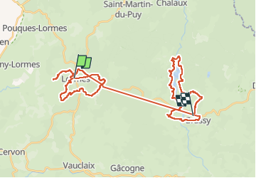

Length
49 km

Max alt
628 m

Uphill gradient
1145 m
Km-Effort
64 km

Min alt
309 m

Downhill gradient
1147 m
Boucle
No
Creation date :
2024-09-02 12:02:27.0
Updated on :
2024-09-03 12:50:09.337
24h40
Difficulty : Very difficult

FREE GPS app for hiking
 SityTrail
IGN / Geographical institutes
SityTrail Plus
The world is yours!
About
Trail Walking of 49 km to be discovered at Bourgogne-Franche-Comté, Nièvre, Lormes. This trail is proposed by raygautier.
Positioning
Country:
France
Region :
Bourgogne-Franche-Comté
Department/Province :
Nièvre
Municipality :
Lormes
Location:
Unknown
Start:(Dec)
Start:(UTM)
561737 ; 5237658 (31T) N.
Comments