CESSNS-TOUR CESAR-13-09-24
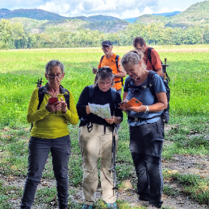
mini balades Adapar
Une équipe à votre service garant de convivialité et bonne humeur
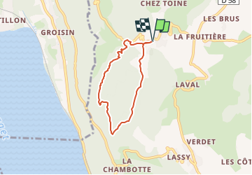

Length
5.4 km

Max alt
842 m

Uphill gradient
212 m
Km-Effort
8.2 km

Min alt
667 m

Downhill gradient
212 m
Boucle
Yes
Creation date :
2024-09-08 14:00:41.209
Updated on :
2024-09-08 14:02:21.306
1h51
Difficulty : Medium

FREE GPS app for hiking
 SityTrail
IGN / Geographical institutes
SityTrail Plus
The world is yours!
About
Trail Walking of 5.4 km to be discovered at Auvergne-Rhône-Alpes, Savoy, Entrelacs. This trail is proposed by mini balades Adapar.
Positioning
Country:
France
Region :
Auvergne-Rhône-Alpes
Department/Province :
Savoy
Municipality :
Entrelacs
Location:
Unknown
Start:(Dec)
Start:(UTM)
723939 ; 5075681 (31T) N.
Comments