


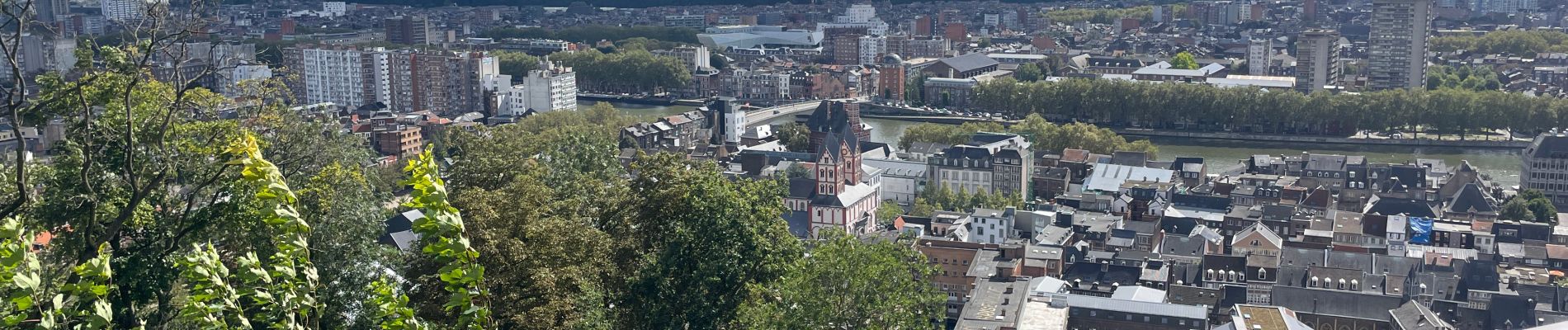
Liège 10 Km

Efr
User
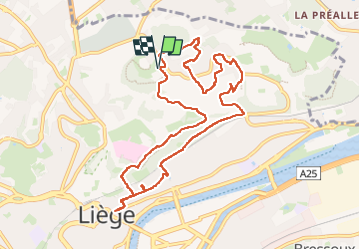

Length
9.8 km

Max alt
193 m

Uphill gradient
266 m
Km-Effort
13.4 km

Min alt
61 m

Downhill gradient
267 m
Boucle
Yes
Creation date :
2024-09-08 09:09:22.0
Updated on :
2024-09-08 16:37:12.969
3h02
Difficulty : Difficult

FREE GPS app for hiking
 SityTrail
IGN / Geographical institutes
SityTrail Plus
The world is yours!
About
Trail Walking of 9.8 km to be discovered at Wallonia, Liège, Liège. This trail is proposed by Efr.
Description
Départ: Bd Hector dénis 4000 Liege
Photos


32 photos in total. Please click on a photo to see them all in the gallery.
Positioning
Country:
Belgium
Region :
Wallonia
Department/Province :
Liège
Municipality :
Liège
Location:
Jupille-sur-Meuse
Start:(Dec)
Start:(UTM)
682527 ; 5615308 (31U) N.
Comments
Super balade