


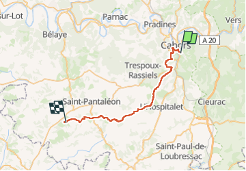
Compostelle Cahors Moncuq

Nono55
User

Length
39 km

Max alt
305 m

Uphill gradient
720 m
Km-Effort
48 km

Min alt
112 m

Downhill gradient
652 m
Boucle
No
Creation date :
2024-09-09 05:56:21.0
Updated on :
2024-09-09 15:58:10.884
7h23
Difficulty : Medium

FREE GPS app for hiking
 SityTrail
IGN / Geographical institutes
SityTrail Plus
The world is yours!
About
Trail Walking of 39 km to be discovered at Occitania, Lot, Cahors. This trail is proposed by Nono55.
Description
Journée sous la pluie Etape vallonné sur les Causses quelles montées difficiles
Positioning
Country:
France
Region :
Occitania
Department/Province :
Lot
Municipality :
Cahors
Location:
Unknown
Start:(Dec)
Start:(UTM)
376416 ; 4921742 (31T) N.
Comments