


bagnol dn foret foret royale

Michel DUBOIS
User
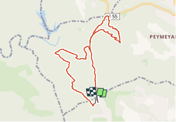

Length
9.6 km

Max alt
323 m

Uphill gradient
203 m
Km-Effort
12.3 km

Min alt
194 m

Downhill gradient
212 m
Boucle
Yes
Creation date :
2024-09-12 06:39:10.65
Updated on :
2024-09-12 09:30:56.365
2h15
Difficulty : Easy

FREE GPS app for hiking
 SityTrail
IGN / Geographical institutes
SityTrail Plus
The world is yours!
About
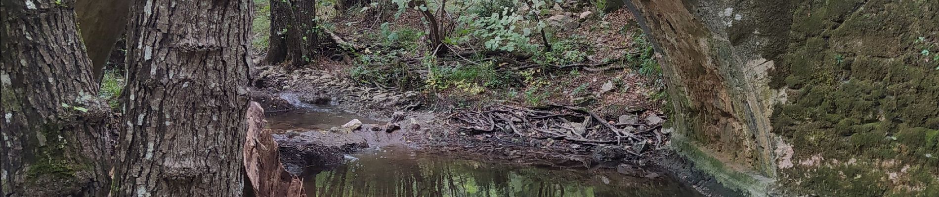
Trail Walking of 9.6 km to be discovered at Provence-Alpes-Côte d'Azur, Var, Bagnols-en-Forêt. This trail is proposed by Michel DUBOIS.
Photos

Positioning
Country:
France
Region :
Provence-Alpes-Côte d'Azur
Department/Province :
Var
Municipality :
Bagnols-en-Forêt
Location:
Unknown
Start:(Dec)
Start:(UTM)
310774 ; 4824304 (32T) N.
Comments