


Claret 00

Dupuybadonniere
User
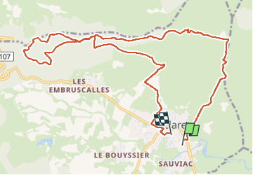

Length
13.4 km

Max alt
414 m

Uphill gradient
344 m
Km-Effort
18 km

Min alt
149 m

Downhill gradient
337 m
Boucle
No
Creation date :
2024-09-13 06:29:40.366
Updated on :
2024-09-13 09:55:30.55
2h50
Difficulty : Difficult

FREE GPS app for hiking
 SityTrail
IGN / Geographical institutes
SityTrail Plus
The world is yours!
About
Trail Walking of 13.4 km to be discovered at Occitania, Hérault, Claret. This trail is proposed by Dupuybadonniere.
Positioning
Country:
France
Region :
Occitania
Department/Province :
Hérault
Municipality :
Claret
Location:
Unknown
Start:(Dec)
Start:(UTM)
572915 ; 4856563 (31T) N.
Comments