


Compostelle Mancier a Gîte Dubarry

Nono55
User
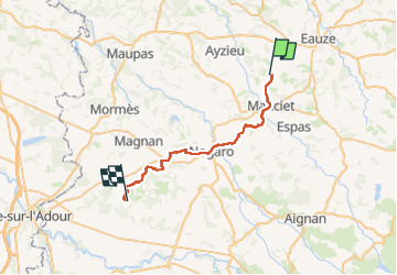

Length
34 km

Max alt
167 m

Uphill gradient
462 m
Km-Effort
41 km

Min alt
92 m

Downhill gradient
476 m
Boucle
No
Creation date :
2024-09-16 05:42:44.0
Updated on :
2024-09-16 14:20:11.143
6h33
Difficulty : Easy

FREE GPS app for hiking
 SityTrail
IGN / Geographical institutes
SityTrail Plus
The world is yours!
About
Trail Walking of 34 km to be discovered at Occitania, Gers, Manciet. This trail is proposed by Nono55.
Description
Départ un peu dangereux sur la route puis chemin en sous bois sympa Arrive au gîte Dubarry chemin pourri

Positioning
Country:
France
Region :
Occitania
Department/Province :
Gers
Municipality :
Manciet
Location:
Unknown
Start:(Dec)
Start:(UTM)
262046 ; 4857184 (31T) N.
Comments